
Scharf Map, drawn around 1900, representing pre-settlement time overlaid with roads from 1900. Box in center is area discussed below. The triangular icon in its center represents the location of a Potawatomi village. The Des Plaines River runs diagonally toward the upper right and Chicago, the other valley directly east to Lake Michigan. The diagonal road in the same direction as the river is Archer Avenue.
Did you ever wonder what it was like here before Lemont was settled, before Illinois was a state?
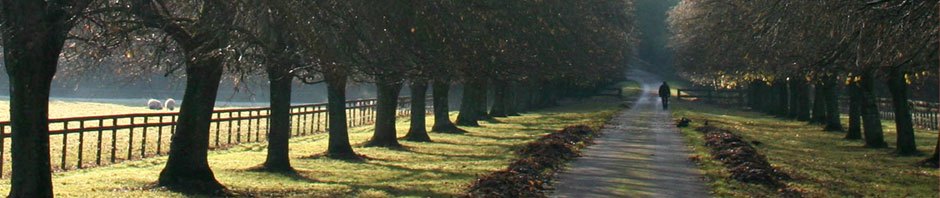
Start by imagining you are walking one of the trails in our beautiful forest preserves, but look at what surrounds the trail and imagine the trail is not there. How would you go from place to place through this wilderness? Where would you be going, and for what reason?
The most convenient way to travel before developed roads was on waterways, rivers and streams that ran through the area. Most American Indian villages were located near water because food was abundant there and travel easier. However, some times of the year water routes were not passable and it was not easy to transport bulky possessions by canoe, so land routes were also needed.
Many people think that Native Americans followed trails that were originally animal trails, specifically deer trails. This is not the case. Deer graze and wander, and their trails are meandering and come to dead ends, as any hunter will tell you. Deer did not develop trails over distances, nor did they have a specific place to go; they only followed the food. So we must assume that trails were developed by Indians who wanted to go from one specific place to another. It may have been to connect seasonal camps, to visit neighboring villages, or even to wage war against an enemy.
One such trail followed what is now Archer Avenue. Let’s see why.
Developed trails would have connected places people wanted to go, and would have followed as close to the familiar waterways as possible, providing a route that was free of such obstacles as swamps that often lined the rivers. Therefore, where cliffs and valleys occurred, such as in the Lemont area, the easiest routes would be on the valley’s ridges.
People coming to northern Illinois from the south would follow the Mississippi River to the Illinois River into the Des Plaines River. From the east they would come through the Great Lakes to where there was a harbor and later Fort Dearborn was built. They also came from Indiana via the Saint Joseph River and Fort Wayne to Lake Michigan, or from downstate following the Wabash River northward. Fort Wayne was the “command post” for the Northwest Territories.
Following the Des Plaines River from the Illinois River, passing Joliet and continuing through the Des Plaines River Valley, just past what is now Lemont, the valley branches to continue northeast to Mud Lake and the Chicago River to present-day downtown Chicago. The other branch went directly east to Lake Michigan via the Calumet River.
At the place where the valleys merge is a forested area on high ground called Mount Forest Island. Today this is the intersection of Rt. 83, Archer Avenue, and 107th Streets. St. James at Sag Bridge and the Cook County Forest Preserves occupy this area, but in the earliest days Indian Villages lined these routes and trails developed between them. The ancient Indian trail that became Archer Avenue connected here to other trails, such as the Vincennes, Sag, and Sauk Trails, going to the south end of Lake Michigan and to the rivers in Indiana.
Across the Des Plaines Valley from this vantage point was an area called Signal Hill. From that place, high on the north bluff of the river, signals could be sent and seen down three branches of the valleys for many miles to the west, east, and northwest. Signal Hill is now part of Waterfall Glen Forest Preserve.
Ultimately, explorers, soldiers, surveyors, opportunists, merchants, tradesmen, squatters, and finally settlers followed the same routes. When construction started on the I&M Canal, a road was needed, and the old Indian trail between Joliet and the Chicago Portage (near 47th and Harlem Avenue) was followed to create Archer Avenue.