
Where: Columbia Woods, Willow Springs Road and Corcoran Road, Willow Springs
When: 10 am to 5 pm Saturday, September 10; 10 am to 4 pm Sunday, September 11
For info: www.ariverthruhistory.com
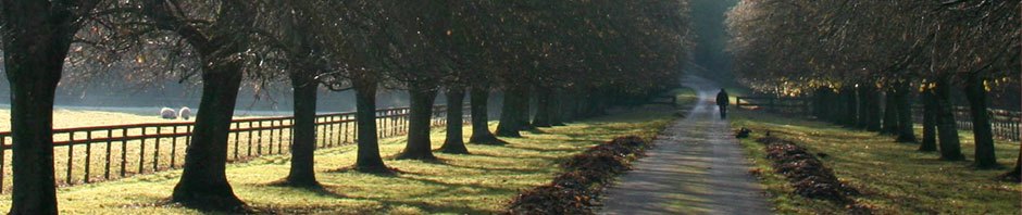
Those of you who follow this blog are well acquainted by now with the importance of the area’s rivers and waterways to the Chicago area. This weekend you have a unique opportunity to see this history first-hand at A River Thru History Rendezvous in Willow Springs. I will be there, signing my new release, The Mystery at Black Partridge Woods, which is set in the time and place that Rendezvous depicts.
If you’ve never been to a reenactment event, here’s your chance. Reenactors select a character from history and play that role, dressing in period costume, camping, displaying trades and authentic items, in a campground located along the river. Visitors can circulate through the camps and talk to the participants, learning about the fur trade era. There will be voyageurs, craftsmen, musicians and entertainers, games, animals, food, storytelling, tomahawk throwing, and more…
My new release, The Mystery at Black Partridge Woods, has a scene that depicts a similar Rendezvous, and a main character is an Indian woman from this time period. I will have the books available for sale and signing at the pavilion. Stop by and say hello!
If you miss this opportunity to get your copy of The Mystery at Black Partridge Woods, I will be at Lemont’s Art Walk on September 16 and my book release party will be on October 1. Watch for more details in upcoming announcements.
What details can you tell us about Signal Hill? Signal Hill used to be a point of interest on the official Illinois road map. It was just west of Rt 83 near Argonne National Laboratory. It has disappeared from the map.
You have the location right. I didn’t realize it was mentioned on the map. You can access the location of Signal Hill if you take the main trail from the Bluff Road parking area for Waterfall Glen. The trail goes south and then bears to the west. Signal Hill is to the east near that turnoff. I don’t know if there are trails that go there, and I believe it is just overgrown now without much to see. If there were a developed overview today it would be marked on the Waterfall Glen map. Perhaps they may see fit to develop an overview there at some future time.
My theory is that it was more than a Native American signaling location. My theory is that it was a very important signaling point for boats going along the waterways all the way from the time of the pioneers; and then up through the days of radio ship to shore communication.
I understand that the US Army Corps of Engineers are in charge of all navigable waterways in the US. I wonder if they have any historical information.
That is an interesting theory but unfortunately I don’t have any information to confirm it. Should you find anything out, please let me know.
You may want to contact the lock master at the Lockport Dam for information. I’ve been able to reach him by email some time ago. If you have never toured the Lockport locks and dam it is well worth doing. They aren’t available often. Best time to check would be in June near Lockport’s Canal Days.