My new release (due soon – stay tuned!) is titled The Mystery at Mount Forest Island. So where is Mount Forest Island, you may ask? It is a triangular-shaped elevation of land between Lemont, Willow Springs and Palos. Most of Mount Forest Island is Cook County Forest Preserves today, but its history is fascinating.

Photo: U.S. Army Corps of Engineers
When the Wisconsin Glacier that covered Northern Illinois retreated 14,000 years ago, the melt waters collected in a glacial basin that geologists called Lake Chicago. The basin created was much larger than Lake Michigan, the shore extending roughly to where LaGrange Road is today.
The waters were held back by a pile of debris left as the glacier advanced and retreated, known as the Valparaiso Moraine. At the southwestern edge of Lake Chicago was a triangular-shaped island that geologists named Mount Forest Island.

Through a complex process over thousands of years, at some point in time the water broke through the moraine at the Chicago Outlet, flowing around Mount Forest Island, creating the Des Plaines River Valley to the northwest, and the Sag Valley to the south. The valleys met at the southwestern tip of Mount Forest Island, which is now not an island but an approximately one hundred foot elevation of land between the two valleys.
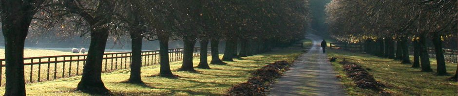
Native Americans lived, hunted and fished along the river and camped, hidden and protected, in the ravines along the valleys. From the bluffs of Mount Forest Island they were able to spot herds of bison and deer, normally hard to find in wooded areas. They could also easily spot invaders on the rivers or by land, making the area ideal for survival.
The Sag Valley was primarily swampland and not navigable. However, just north of Mount Forest Island the Des Plaines River approached the Chicago River, with only a long marsh called Mud Lake between. During spring rains the area between the two rivers became navigable. Native Americans used the rivers and developed trails along them.
Then an important event happened in 1673 when Pere Marquette and Louis Joliet traveled through the area. It is not documented, but is likely, that they stopped at Mount Forest Island, near where St. James at Sag Bridge is today on its southwestern tip. It is known that they learned from the natives of the portage at Mud Lake, and realized that a canal built between the rivers would establish a transportation route between the Great Lakes and the Mississippi River via the Des Plaines and Illinois Rivers.
Marquette stated in his journal:
We have seen nothing like this river that we enter, as the fertility of the soil, its prairies and woods; its cattle (bison), elk, deer wildcats, bustards, swans, ducks, parroquets, and even beaver. There are many small lakes and rivers. That on which we sail is wide, deep and still…in the spring and during part of the summer there is only one portage of half a league. (Mud Lake)
The I and M Canal was eventually built and opened, but not until 1848, 175 years later. The Sag Valley also connects to Lake Michigan via the Calumet River. This geography had much to do with the development of Chicago as a major city and transportation hub, as the routes connected the interior of the country to established ports on the east coast and Gulf of Mexico by way of the Great Lakes and Mississippi River.

South of Mount Forest Island was dug deeper and became the Calumet-Sag Channel, part of the plan to reverse the flow of the Chicago River. The northern portion of the glacial valley (north of Mount Forest Island) was dug deeper and became the Chicago Sanitary and Ship Canal, drawing Lake Michigan water to flow toward and eventually reach the Illinois River.
However, by the end of the 1800s sanitation issues on the canal made it necessary to revise the canal system. The Sanitary and Ship Canal replaced the I and M Canal, the direction of the Chicago River was changed, and later the Cal-Sag Channel was dug through the Sag Valley to connect to the Sanitary Canal. The canals meet in Lemont at the southwest point of Mount Forest Island.

This photo shows where the Cal Sag meets the Sanitary Canal in today’s Lemont. The wider channel on the right is the Cal Sag, the narrow one on the left the Sanitary Canal. The body of water at top is Saganashkee Slough in the Sag Valley. The wooded wedge of land between the two canals is Mount Forest Island. The Des Plaines River runs parallel to the Sanitary Canal to the left (West) and cannot be seen in the photo. The lower bridge is railroad, the upper one Archer/Rt. 83. The Sag Quarries can be seen to the right of the upper bridge.
Today the elevation that was once Mount Forest Island is mostly Forest Preserves owned and managed by Cook County. At one time these preserves operated a golf course, and in the 1940s a laboratory that conducted research as part of the Manhattan Project. Today it is bike and bridle trails, picnic groves and lakes for the enjoyment of all. The towns of Lemont, Willow Springs, Palos Park, Palos Hills, and Hickory Hills ring its edges.
For the interested, I suggest you check out the Facebook page titled Exploring Mount Forest. I have only touched on its marvels in this blog.
Some months ago, I was driving from Lemont to La Grange, and left inbound Route 55 to exit onto Joliet Road. It was a clear day, and as I headed east past Indian Head Park I suddenly noticed the vast depressed landscape ahead. I realized with surprise and delight that what I was looking at was the ancient bed of Lake Chicago!
Fascinating.
Deat Pat
Good story, but I contend Mt.Forest is a lot more important in the contact era than anyone realizes. Advocates of the Mud lake portage cannot prove it was the original portage of Marquette and La Salle., That is one thwory. There are those who theorize the original portage was viral the Calumet river Stony Creek and sag e as the true route from the DesPlaines River to lake Michigan. Indeed a string of earthworks from antiquity located on the Southern side of Mt Forest,facing the Sag add credence to this theory. In either case Mt Forest is the cork in the bottle of any water passage.